

Published Dec 27th, 2015, 12/27/15 11:22 pm
- 935 views • 1 today
- 74 downloads • 0 today

103
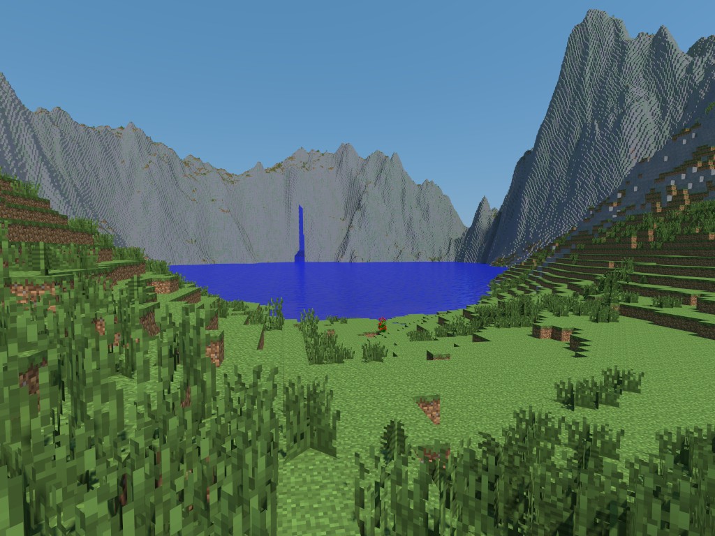
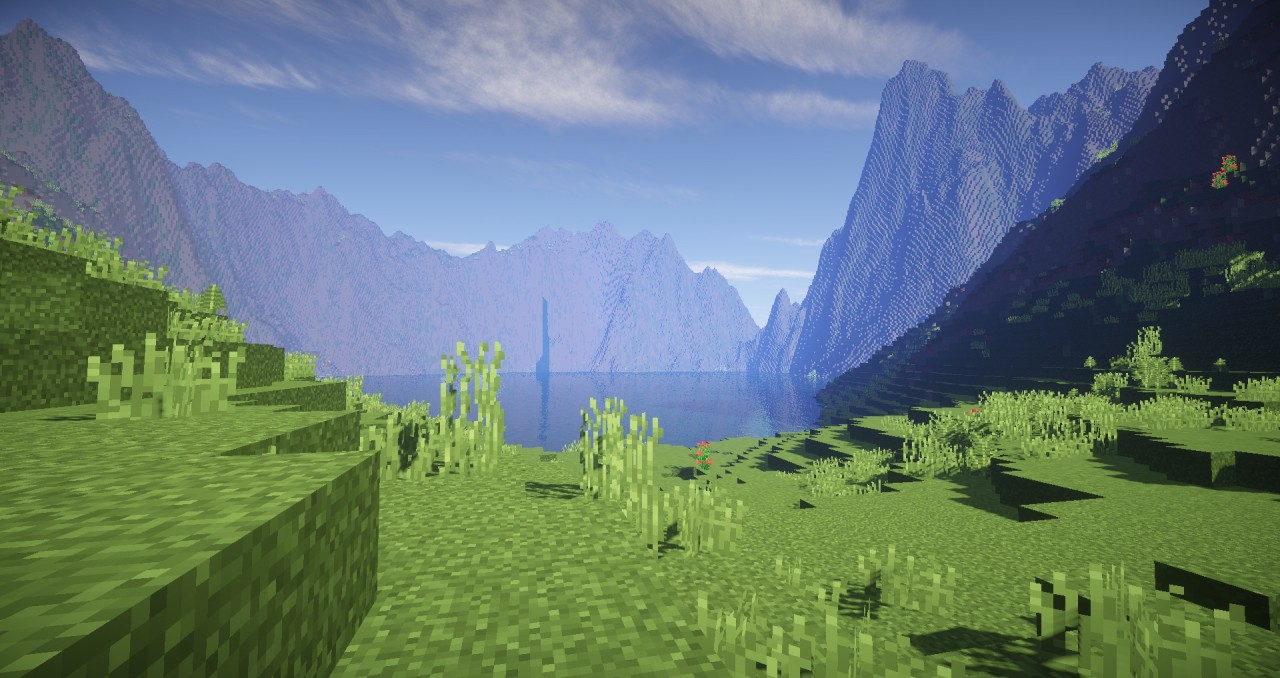
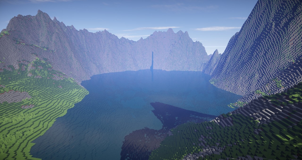
This is my first try at Recreating landmarks in the world we have today through terrain, I chose Pinatubo becuase the image of it is stunning and inpired me.
Mount Pinatubo (Filipino: Bundok Pinatubo) is an active stratovolcano in the Cabusilan Mountains on the island of Luzon, near the tripoint of the Philippine provinces of Zambales, Tarlac, and Pampanga. Before the volcanic activities of 1991, its eruptive history was unknown to most people. It was heavily eroded, inconspicuous and obscured from view. It was covered with dense forest which supported a population of several thousand indigenous people, the Aetas, who fled to the mountains during the Spanish conquest of the Philippines.
The volcano's Plinian / Ultra-Plinian eruption on 15 June 1991 produced the second largest terrestrial eruption of the 20th century after the 1912 eruption of Novarupta in the Alaska Peninsula. Complicating the eruption was the arrival of Typhoon Yunya (Diding),
bringing a lethal mix of ash and rain to areas surrounding the volcano.
Successful predictions at the onset of the climactic eruption led to
the evacuation of tens of thousands of people from the surrounding
areas, saving many lives, but the surrounding areas were severely
damaged by pyroclastic flows, ash deposits, and subsequently, by the lahars
caused by rainwaters re-mobilizing earlier volcanic deposits causing
extensive destruction to infrastructure and changing the river systems
months to years after the eruption.
| Progress | 100% complete |
| Tags |
3560661
2
![Coastline [Custom 2k x 2k Terrain] Minecraft Map & Project](https://static.planetminecraft.com/files/resource_media/screenshot/1819/canyontestedit-1525895778_thumb.jpg)
![Clear Cut Forest [Custom Terrain] Minecraft Map & Project](https://static.planetminecraft.com/files/resource_media/screenshot/1727/858iqhi-1499272201_thumb.jpg)
![A Decaying Planet [4,000x4,000 Custom Terrain] Minecraft Map & Project](https://static.planetminecraft.com/files/resource_media/screenshot/1648/hhbsosh10688102_thumb.jpg)


 Neo64
Neo64


 KnotXackly

![World Cup 2026 [FREE] [DOWNLOAD] Minecraft Map & Project](https://static.planetminecraft.com/files/image/minecraft/project/2026/877/19901789-wc_s.jpg)
 Moskayyy
![Minecraft Flamingos [Pack] Statue! Download Minecraft Map & Project](https://static.planetminecraft.com/files/image/minecraft/project/2026/308/19900096_s.jpg)
 GuardianYT
Have something to say?