
• 3/11/18 12:26 am
- 3.8k views • 0 today
- Progress
- 50% complete
- 4
- 1
- 1

7
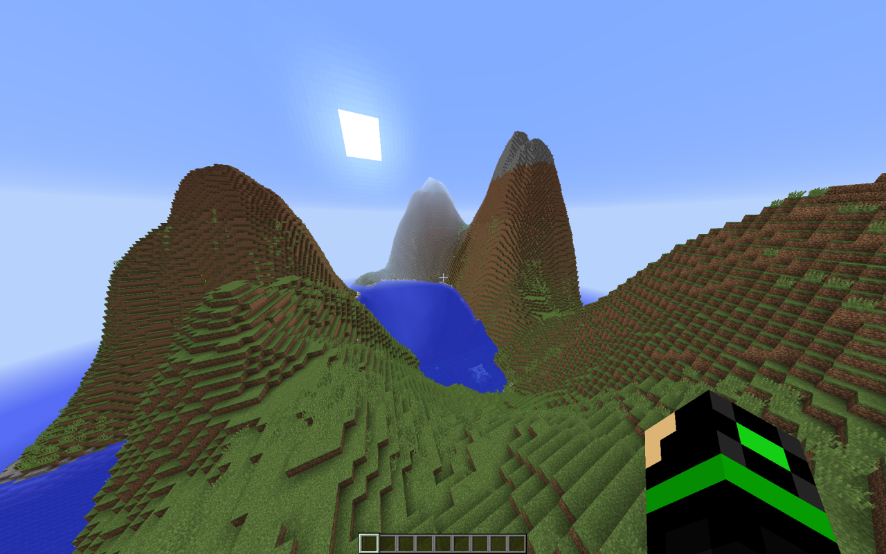
I wrote a program to generate customizable heightmaps. It is written in Java. You can download it here.
This program works by taking multiple layers of terrain zoomed to different levels and combines them. One layer could be hills, another one for boulders, etc.
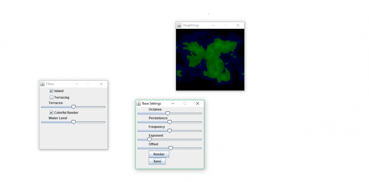
Here is a description of the parameters available:
..and on the Filters window:
This program is free, and you can use it for whatever you want (or distribute it) as long as you credit me and it stays under these terms.
EDIT: Updated, added the Colorful Render feature
This program works by taking multiple layers of terrain zoomed to different levels and combines them. One layer could be hills, another one for boulders, etc.
Here is a description of the parameters available:
- Octaves: The number of layers to be combined. A larger number gives more complex terrain.
- Persistence: The strength of each layer. The strength of each layer decreases as more and more are added; this parameter determines how fast it decreases.
- Frequency: How zoomed in the heightmap is. Lower values give flatter, smoother terrain.
- Exponent: The exponent to which the heightmap is raised. Higher values give more contrasting (spiky) terrain; low values give a boring terrain.
- Offset: How much the terrain is offset from zero.
- Render: Update the heightmap viewing window.
- Save: Save the contents of the heightmap viewing window to a file named "output.png"
..and on the Filters window:
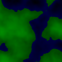
- Island: Generate an island.
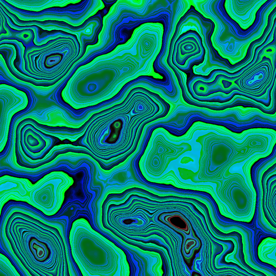
- Terracing: Split the landscape into terraces.
- Terraces: The number of terraces. A larger number means coarser landscape.
- Colorful Render: Whether the heightmap should be colorful or not.
- Water Level: The level at which water is present. This is only applied with the Colorful Render.
This program is free, and you can use it for whatever you want (or distribute it) as long as you credit me and it stays under these terms.
EDIT: Updated, added the Colorful Render feature
More like this
 HeightMap River for World PainterEnvironment / Landscaping Map
 Toryar - OGC
•7/22/20 4:16
11.9k 3.5kx 82123
Toryar - OGC
•7/22/20 4:16
11.9k 3.5kx 82123 Distonia and Gallionia Height Maps for World PainterEnvironment / Landscaping Map
 KaligarPrime
7/29/20 12:58
• posted 7/23/20 1:40
9.8k 959 6x 8116
KaligarPrime
7/29/20 12:58
• posted 7/23/20 1:40
9.8k 959 6x 8116 My Custom HeightmapEnvironment / Landscaping Map
 watchmanT
12/30/12 11:58
• posted 12/28/12 5:49
4.5k 192x 231
watchmanT
12/30/12 11:58
• posted 12/28/12 5:49
4.5k 192x 231
 Island Chain Custom Survival World - MULTIPLE BIOMES 1.8-1.10Environment / Landscaping Map
 Emrison
•7/14/16 9:59
691 21x 52
Emrison
•7/14/16 9:59
691 21x 52
 Tqrtl
Tqrtl4102665
2


 creampuff_cat


 Enveil
 Samismynickname


 TryzzMC

 Dy1ax7
 Druzhina Team
 ZENIIXX
Have something to say?