


2
Using archives from several sources including HistoricMapWorks.com, Wikipedia and Google Maps, I am attempting to build a replica of the downtown area of Columbus, Ohio.
I am getting the base from the Columbus and Vicinity plat book, created in 1937 by the Franklin Survey Company. The maps it contains can be viewed at this link: www.historicmapworks.com/Atlas/US/22853/Columbus+and+Vicinity+1937/
Current status:
Streets around the Statehouse built
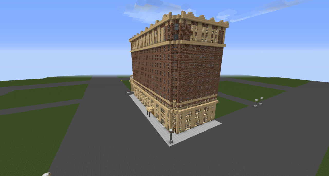
Deshler-Wallick Hotel exterior completed
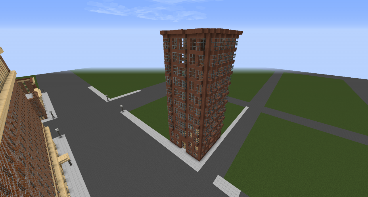
Wyandotte Building exterior completed
6 E Broad St./2-10 N High St. exterior completed
The first version of the map will be released upon completion of the Deshler-Wallick Hotel, LeVeque Tower, R.K.O. Palace Theatre, 8 East Broad Street, 16 East Broad Street, 20 East Broad Street, and the Wyandotte Building.
Map compatible with: Minecraft 1.10
Credit to the Greenfield Team for the resource pack, I am using it for this.
I am getting the base from the Columbus and Vicinity plat book, created in 1937 by the Franklin Survey Company. The maps it contains can be viewed at this link: www.historicmapworks.com/Atlas/US/22853/Columbus+and+Vicinity+1937/
Current status:
Streets around the Statehouse built
Deshler-Wallick Hotel exterior completed
Wyandotte Building exterior completed
6 E Broad St./2-10 N High St. exterior completed
The first version of the map will be released upon completion of the Deshler-Wallick Hotel, LeVeque Tower, R.K.O. Palace Theatre, 8 East Broad Street, 16 East Broad Street, 20 East Broad Street, and the Wyandotte Building.
Map compatible with: Minecraft 1.10
Credit to the Greenfield Team for the resource pack, I am using it for this.
| Credit | GreenfieldMC, for the resource pack. |
| Progress | 0% complete |
| Tags |
tools/tracking
3788240
2
city-of-columbus-ohio-downtown-amp-franklinton


 ScotsMiser
 Atten007
 Cirxett

 Krysot
 realSavageMan

![Tecova's Watchtower [Schem] Minecraft Map & Project](https://static.planetminecraft.com/files/image/minecraft/project/2024/569/17756169_s.jpg)
 Tecovical
Create an account or sign in to comment.