


• 11/26/13 7:17 am
- 3.3k views • 2 today
- save_alt 204 downloads • 0 today
- Progress
- 100% complete
Added CreditThis map is in honor of TDWP_FTW, lead for th… info

53
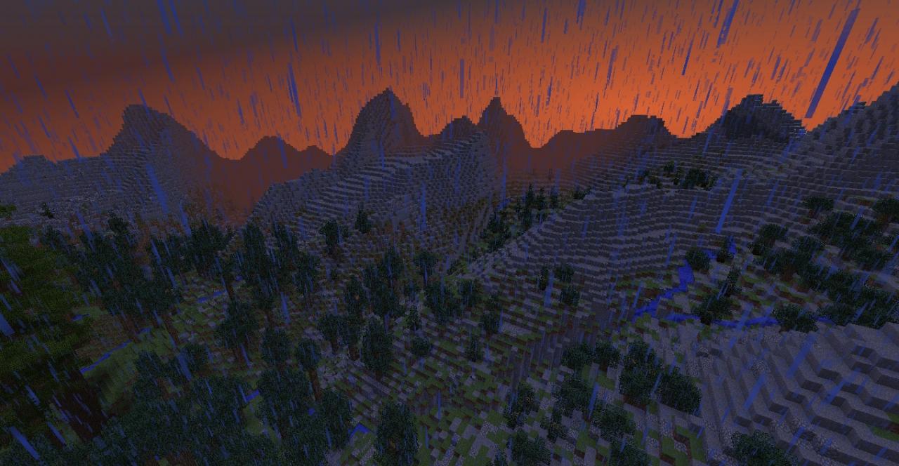
A small (~600x600) island with an grand chain of mountains created using real world topography. There are beaver-dams, lakes with logjams, gigantic pine trees, hanging glaciers, waterfalls, short narrow slot canyons and more... Details make an epic map, not cone-shaped fantasy peaks...
The game is survival ready, just /gamemode 0. I've placed signs with the actual names of several prominent landmarks. Kudos to anyone who can provide me with approximate lat/longs for the actual location on which the mountains are modeled.
If you like the map, but have suggestions for improvement, I'd like to hear it...
Works Cited:
90m. Digital Elevation Model
www.ambiotek.com/topoview/srtm41.kmz
MicroDEM, For generating a height map to import into WorldPaint
http://www.usna.edu/Users/oceano/pguth/website/microdem/microdem.htm
Gimp, for converting MicroDEM bmps into grayscale (height map), touching up screenshots
http://www.gimp.org/
Worldpainter, all kinds of awesomeness
www.worldpainter.net/
MCEdit, more kinds of awesomeness
www.mcedit.net/
Custom Tree Repository, with WorldPainter, this project is beautiful
http://www.planetminecraft.com/project/native-trees-of-europe-template-repository-1779952/
Chunky, image rendering
http://www.minecraftforum.net/topic/63913-chunky-minecraft-mapping-and-rendering-tool/
The game is survival ready, just /gamemode 0. I've placed signs with the actual names of several prominent landmarks. Kudos to anyone who can provide me with approximate lat/longs for the actual location on which the mountains are modeled.
If you like the map, but have suggestions for improvement, I'd like to hear it...
Additional Notes
Works Cited:
90m. Digital Elevation Model
www.ambiotek.com/topoview/srtm41.kmz
MicroDEM, For generating a height map to import into WorldPaint
http://www.usna.edu/Users/oceano/pguth/website/microdem/microdem.htm
Gimp, for converting MicroDEM bmps into grayscale (height map), touching up screenshots
http://www.gimp.org/
Worldpainter, all kinds of awesomeness
www.worldpainter.net/
MCEdit, more kinds of awesomeness
www.mcedit.net/
Custom Tree Repository, with WorldPainter, this project is beautiful
http://www.planetminecraft.com/project/native-trees-of-europe-template-repository-1779952/
Chunky, image rendering
http://www.minecraftforum.net/topic/63913-chunky-minecraft-mapping-and-rendering-tool/
2603671
2


 MaxCubed
 PixelCraft


 Reer123

 TryzzMC
 Manuel_Fox

Have something to say?
www.youtube.com/watch?v=Wha2m4_CPoo
The problem is that its 90m elevation data (1 pixel / 90meters) so if you want better detail you have to google "usgs seamless" and get 10m USA data